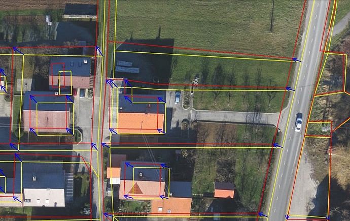
High-quality spatial data is essential for making numerous decisions concerning the use and development of space. Data from the real estate cadastre plays a particularly important role in spatial planning, management and monitoring. In Slovenia, the real estate cadastre is the primary official register of real estate, but the positional accuracy of the data it contains is not always adequate.
When is positional accuracy improvement needed?
The use of cadastral data can be significantly limited by the lower positional accuracy of the data. Poor positional accuracy is reflected in larger discrepancies, sometimes amounting to several metres, between the cadastral map, which shows parcel boundaries and parcel numbers, and the actual situation on the ground.
These discrepancies have arisen as a result of different surveying technologies and procedures used to create and maintain cadastral maps over time. They become particularly apparent when the cadastral map is overlaid with other data layers, such as an orthophoto.
Why improve the positional accuracy of real estate cadastre data?
The process of improving the cadastral map does not eliminate major errors that may have occurred during the maintenance of the real estate cadastre. It does not replace boundary determination procedures or a surveying plan. Nevertheless, improving the positional accuracy provides a number of benefits – the resulting cadastral map becomes consistent with the orthophoto and other maps, such as maps of public utility infrastructure.
The cadastral map therefore provides a more reliable representation of the situation on the ground and serves as a useful basis for municipal spatial plans and preliminary designs, particularly for infrastructure development. It also makes it easier to assess whether cadastral data is up to date.
In addition, the resulting cadastral map is suitable for use in geographic information systems (GIS), as it provides greater positional accuracy of real estate cadastre data. Finally, this methodology can result in significant cost savings, particularly compared with a new survey, which is time-consuming and involves substantial costs.
Improving positional accuracy enables:
- easier preparation and implementation of municipal and national spatial plans, agricultural policy measures and environmental protection measures
- easier property valuation and taxation
- more efficient management of transport and utility infrastructure
- a better understanding of property rights and easier planning of interventions in space
See other services from the group Real Estate Cadastre
- Boundary Determination and Registration
- Land Partitioning
- Registration of a Building and Its Parts
- Registration of Changes to Data on a Building and Its Parts
- Boundary Marking
- Boundary Adjustment
- Boundary of Length Objects Determination
- Improving the Positional Accuracy of Parcel and Building Footprint Data
- Land Consolidation
- New Cadastral Survey
- Change in Land Quality Rating
- Land Plot Identification
- Determination of the Area of a Building Right and Easement